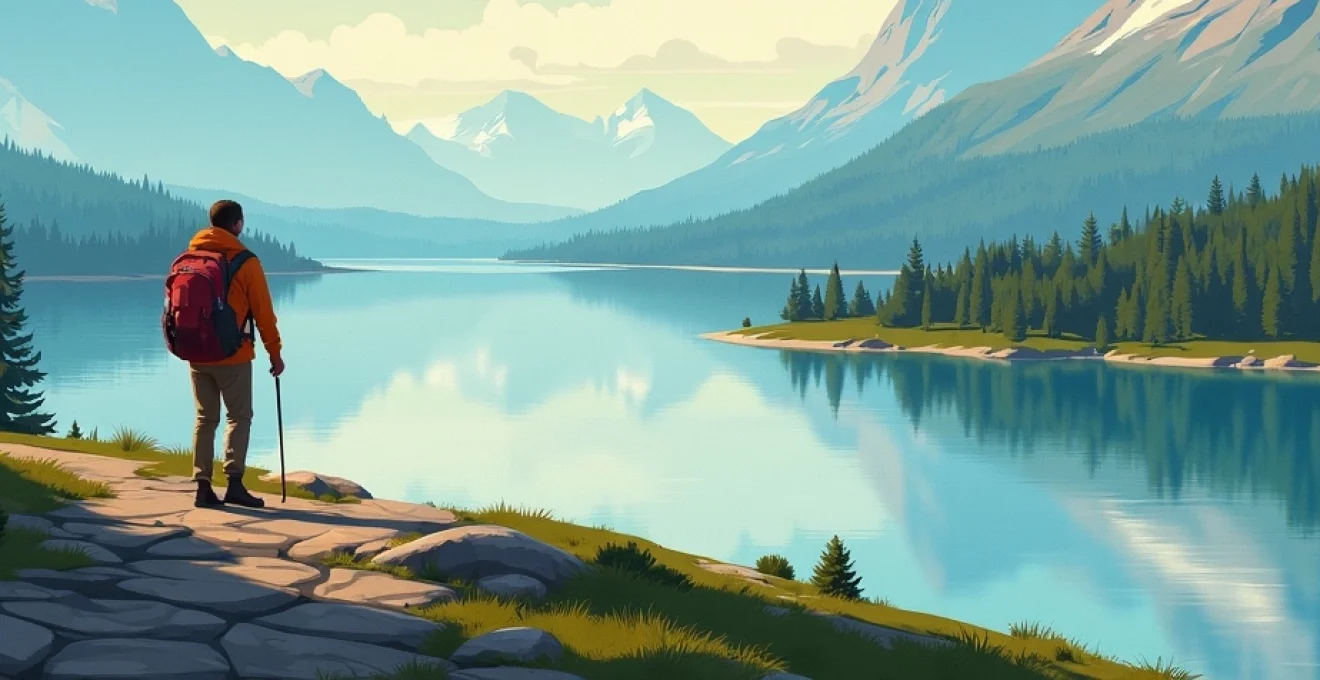
Cartography has long been an essential tool for travelers and adventurers seeking to navigate the diverse landscapes of Scandinavia. From the rugged fjords of Norway to the archipelagos of Sweden and the coastal plains of Denmark, maps provide invaluable insight into the region’s unique geography. As technology advances, digital mapping tools are revolutionizing how we explore these Nordic countries, offering unprecedented detail and interactivity. However, understanding the rich cartographic history of Scandinavia remains crucial for appreciating its cultural and geographical evolution.
Cartographic resources for scandinavian exploration
Explorers venturing into Scandinavia have a wealth of cartographic resources at their disposal. Traditional paper maps, still cherished by many outdoor enthusiasts, offer a tangible connection to the landscape. These physical maps, produced by national mapping agencies like Lantmäteriet in Sweden and Kartverket in Norway, provide detailed topographical information essential for hikers and mountaineers.
Digital mapping platforms have dramatically expanded the accessibility and functionality of Scandinavian maps. Apps like Norgeskart for Norway and Hitta.se for Sweden offer comprehensive digital maps with features such as route planning, real-time GPS tracking, and points of interest. These tools have become indispensable for both urban exploration and wilderness adventures.
For those interested in historical perspectives, archives like the Royal Library of Denmark house extensive collections of historical maps dating back centuries. These cartographic treasures offer fascinating insights into how Scandinavia’s landscape and borders have evolved over time.
Cartography is not just about representation; it’s about understanding the intricate relationships between land, sea, and human activity that shape Scandinavia’s unique character.
Topographical features of sweden’s diverse landscapes
Sweden’s geography is characterized by a remarkable diversity of landscapes, from the dense forests of the south to the arctic tundra of the north. Topographical maps of Sweden reveal a country dominated by lakes, forests, and a long Baltic coastline. The country’s highest peaks are found in the northwest, where the Scandinavian Mountains form a natural border with Norway.
Navigating the stockholm archipelago
The Stockholm Archipelago presents a unique cartographic challenge. Consisting of over 30,000 islands, islets, and skerries, this maritime landscape requires specialized nautical charts. Modern digital mapping tools have greatly improved navigation in this complex environment, offering real-time updates on water depths, currents, and potential hazards.
Sailors and kayakers exploring the archipelago rely on detailed charts that not only show the islands but also indicate safe passages and anchorages. The Swedish Maritime Administration ( Sjöfartsverket ) provides official nautical charts that are regularly updated to reflect changes in the archipelago’s dynamic environment.
Mapping kebnekaise and the swedish lapland
In the far north of Sweden, the Kebnekaise massif presents a formidable cartographic subject. As Sweden’s highest mountain, Kebnekaise is a focal point for mountaineers and researchers alike. Detailed topographical maps of this area show not only elevation contours but also glacial features, which are crucial for understanding the region’s changing climate.
The Swedish Lapland, stretching across the Arctic Circle, requires specialized mapping techniques to accurately represent its unique subarctic landscape. Cartographers must account for the region’s vast wilderness areas, reindeer migration routes, and the traditional lands of the Sami people.
Orienteering through götaland’s forests
The forests of Götaland in southern Sweden are a haven for orienteering enthusiasts. Highly detailed orienteering maps of this region use specific symbols to represent features like vegetation density, rock formations, and man-made structures. These maps are designed for precise navigation and are often created at scales as large as 1:10,000 or even 1:5,000 for competitive events.
The Swedish Orienteering Federation ( Svenska Orienteringsförbundet ) maintains strict standards for these specialized maps, ensuring consistency and accuracy across different terrains and competitions.
Charting sweden’s coastal fjords and inlets
Sweden’s western coast is characterized by numerous fjords and inlets, creating a complex shoreline that demands detailed cartographic representation. Nautical charts of this area must accurately depict water depths, underwater hazards, and tidal information. The Bohuslän coast, in particular, is renowned for its intricate archipelago, requiring careful navigation and precise mapping.
Modern bathymetric surveys have greatly improved the accuracy of these coastal charts, providing invaluable information for both commercial shipping and recreational boating.
Denmark’s cartography: islands, peninsulas, and straits
Denmark’s geography presents a unique cartographic challenge, with its composition of one large peninsula (Jutland) and numerous islands. The country’s relatively flat terrain means that even small changes in elevation can have significant implications for land use and flood risk management.
Mapping the jutland peninsula’s shifting coastlines
The western coast of Jutland is a dynamic environment, constantly shaped by wind and waves. Cartographers must regularly update maps of this region to reflect changes in the coastline, sand dunes, and barrier islands. The Danish Coastal Authority ( Kystdirektoratet ) conducts regular surveys to monitor these changes and inform coastal management strategies.
Historical maps of Jutland reveal dramatic shifts in the coastline over centuries, providing valuable data for understanding long-term coastal processes and predicting future changes.
Navigating copenhagen’s urban grid and waterways
Mapping Copenhagen requires a blend of urban cartography and maritime charting. The city’s extensive canal system and harbor areas necessitate detailed nautical charts, while its complex urban grid demands precise street mapping. Modern digital maps of Copenhagen often integrate public transportation routes, bicycle lanes, and pedestrian zones, reflecting the city’s focus on sustainable urban mobility.
Historical maps of Copenhagen, such as those from the 17th and 18th centuries, offer fascinating insights into the city’s development from a fortified town to a modern capital.
Charting the danish straits: øresund, great belt, and little belt
The Danish Straits are crucial waterways connecting the Baltic Sea to the North Sea. Accurate nautical charts of these straits are essential for maritime safety and international shipping. These charts must account for varying water depths, strong currents, and the presence of bridges and tunnels.
The construction of the Øresund Bridge between Denmark and Sweden in 2000 necessitated significant updates to nautical charts of the region, illustrating how major infrastructure projects can impact cartography.
Exploring bornholm’s unique geological features
The island of Bornholm, located in the Baltic Sea, presents a distinct geological landscape within Denmark. Topographical maps of Bornholm reveal its unique rocky terrain, cliffs, and forests, which contrast sharply with the rest of Denmark’s predominantly flat landscape. Geological maps of the island are particularly valuable for understanding its rich mineral deposits and distinctive rock formations.
Bornholm’s cartography offers a window into Denmark’s diverse geological history, showcasing landscapes more akin to Sweden than the Danish mainland.
Norway’s complex terrain: fjords, mountains, and arctic regions
Norway’s dramatic landscape poses significant challenges for cartographers. The country’s extensive fjord systems, towering mountain ranges, and vast arctic territories require diverse mapping techniques to accurately represent their complexities.
Mapping the fjords: geirangerfjord and nærøyfjord
Norway’s fjords, such as the UNESCO World Heritage sites of Geirangerfjord and Nærøyfjord, demand specialized cartographic approaches. Nautical charts of these areas must accurately depict the steep underwater topography, while terrestrial maps need to represent the dramatic elevation changes of the surrounding mountains. Modern 3D mapping techniques have revolutionized how these complex landscapes are visualized, offering immersive views of the fjords’ grandeur.
Bathymetric surveys of the fjords provide crucial data for understanding their underwater ecosystems and informing sustainable tourism practices in these sensitive environments.
Navigating the jotunheimen national park’s peaks
The Jotunheimen National Park, home to Norway’s highest peaks, requires detailed topographical mapping for hikers and mountaineers. Maps of this region must accurately represent not only elevation contours but also glaciers, mountain huts, and hiking trails. The Norwegian Trekking Association ( Den Norske Turistforening ) produces specialized maps for this area, incorporating vital information for safe mountain navigation.
Recent advances in satellite imagery and LiDAR technology have greatly improved the accuracy of elevation data in these mountainous regions, allowing for more precise 3D modeling of Norway’s most challenging terrains.
Charting the lofoten islands’ rugged coastline
The Lofoten archipelago presents a unique cartographic subject, combining dramatic mountain landscapes with intricate coastal features. Nautical charts of this area must account for the islands’ steep underwater drop-offs, strong tidal currents, and numerous small harbors. Terrestrial maps of Lofoten need to represent the islands’ distinctive peaks, known as the Lofoten Wall, which rise dramatically from the sea.
Historical fishing charts of the Lofoten area provide fascinating insights into the region’s maritime heritage and the evolution of its fishing grounds.
Mapping routes through norway’s arctic svalbard archipelago
The Svalbard archipelago, lying far north of the Arctic Circle, requires specialized Arctic mapping techniques. Cartographers must account for the region’s unique challenges, including shifting ice conditions, polar bear habitats, and the absence of traditional landmarks in the tundra landscape. Satellite imagery plays a crucial role in updating maps of this remote area, particularly for monitoring sea ice extent and glacier movements.
Maps of Svalbard often include information on wildlife protection zones, scientific research stations, and historical sites related to Arctic exploration and whaling.
Digital mapping technologies for scandinavian travel
The digital revolution has transformed how travelers explore Scandinavia. GPS-enabled smartphones and tablets now serve as portable mapping devices, offering real-time navigation and location-based services. Apps like Norgeskart for Norway and Hitta.se for Sweden provide comprehensive digital maps with features such as route planning, points of interest, and even augmented reality overlays.
Geographic Information Systems (GIS) have become invaluable tools for both cartographers and travelers. These systems allow for the integration of multiple data layers, providing rich, interactive maps that can display everything from hiking trails and campsites to geological features and wildlife habitats.
Crowdsourced mapping platforms like OpenStreetMap have also made significant contributions to Scandinavian cartography. These collaborative projects often capture local knowledge and rapidly changing features that might be missed by official mapping agencies.
Historical cartography of scandinavia: viking routes to modern surveys
The cartographic history of Scandinavia is as rich and varied as its landscapes. Early Norse explorers relied on rudimentary charts and astronomical navigation, leaving behind artifacts like the Viking sunstone that hint at sophisticated navigation techniques.
The Age of Exploration saw significant advancements in Scandinavian cartography. Danish cartographer Claudius Clavus produced one of the earliest maps of the Nordic countries in the 15th century. The 16th and 17th centuries brought more detailed surveys, with works like Olaus Magnus’s Carta Marina (1539) providing comprehensive depictions of Scandinavian geography, complete with sea monsters and other folkloric elements.
The establishment of national mapping agencies in the 19th century marked a new era of systematic, scientific cartography in Scandinavia. These institutions, such as the Swedish Lantmäteriet (founded in 1628 but modernized in the 19th century) and the Norwegian Kartverket (established in 1773), have been at the forefront of cartographic innovation ever since.
Today, Scandinavian cartography continues to evolve, embracing new technologies while preserving the rich traditions of the past. From Viking charts to satellite imagery, maps remain an essential tool for understanding and exploring the diverse landscapes of Sweden, Denmark, and Norway.